


Thankfully, the weather is still on the relatively good side of way too hot—so why not get out and take a hike? Havasu is ideally suited for exploring the great outdoors. Mohave County has a population density of 15, meaning, on average, we have 15 people per square mile—compared to Los Angeles County that has a population density of over 2,200! Here are a few of our favorite spots to get you started.
Chemehuevi Wash Trail
Easy, scenic hike through a short canyon that leads to a wide wash that ends at the lake. The trail ends at two BLM campsites. Each site has picnic tables and restrooms.
Location: South end of Powell Drive
Length: 4 miles
Time: 2 hours
Directions: Go south on Hwy 95; turn right on Acoma Blvd and make an immediate left on Sweetwater Ave. Turn right on Powell Drive and park at the end.
Pittsburg Mines Trail
Leads to an abandoned mining area located along the foothills of the mountains. The mines have since been filled in or fenced. The hill at the end of the hike offers spectacular views.
Location: Near the north end of Cherry Tree Blvd
Length: 4 miles
Time: 3 hours
Directions: From McCulloch Blvd, drive to the north end of Cherry Tree Blvd. Turn right on Tierra Vista, then left on Del Sol to a culvert just past Corte Cabrillo. The trailhead is at the end of the culvert.
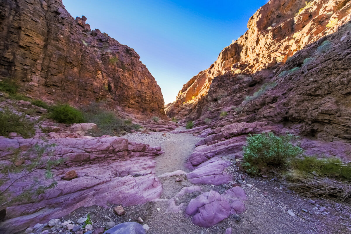
Crack in the Wall Trail (“SARA Crack”)
Hike passes through one of the most famous slot canyons on the lower Colorado and brings you out to a scenic cove on the lake marked by a unique formation known as Balance Rock—a huge rock mass precariously balanced atop a narrow pillar of withering stone. The geology along this trail is a must-see!
Location: SARA Park
Length: 5 miles
Time: 3 hours
Directions: Drive south on Hwy 95 to McCulloch Blvd (mile post 177). Turn right and travel ¾ mile to the parking lot in SARA Park on the right (elev 860 ft).
Lizard Peek Trail (Picnic Table Mountain Trail)
This trail was established in 1982 by Tim O’Connor and the Leaping Lizard Tribe who hand-carried the table to the top and built up the grade. Provides a 360° panoramic view of the Lake Havasu area from an elevation of 1,370 feet above sea level. Look for the 80-foot-long lizard geoglyph below on your way up. This hike is rated as strenuous, with climbing and long steep slopes.
Location: SARA Park
Length: 4 miles
Time: 3 hours
Directions: Drive south on Hwy 95 to McCulloch Blvd (mile post 177). Turn right and travel ¾ mile to the parking lot in SARA Park on the right.